BACK BACK TO SMALL MAP BACK TO TOPOGRAPHY HOME
Note: the "Agas" map, which forms the foundation of the present map, was drawn circa 1557. By the time of the Phoenix's erection in 1617, sixty years later, Drury Lane was a thriving and much built-up suburb. The Phoenix, which was probably built on the site of a Cockpit that had burned, was not surrounded by open fields as here illustrated. The geographical location, however, is as accurate as scholarship can attain.
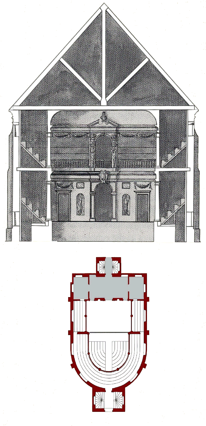
The illustration that follows was made by Inigo Jones and was once generally thought to represent the Phoenix/Cockpit theatre. Recent scholarship has determined that it is in the style of Jones circa 1638 and therefore represents the theatre that Davenant proposed to build in Fleet Street (See Harris, John and Higgott, Gordon, Inigo Jones: Complete Architectural Drawings (London: Royal Academy of Arts, 1989)). This illustration nevertheless forms the basis of the map rendering as there are no other reliable representations of indoor theatres that might otherwise resemble the Phoenix. This therefore should not be taken as authoritative for that theatre. It is, in fact, probably more significant as a departure from earlier theatres such as the Phoenix. This design was probably meant to be a convertible stage that could be changed, according to the demands of the production, from an old-fashioned thrust arrangement to a proscenium stage popular with court performances and masques.